Back to tour City center: from the main station to Wittelsbacherplatz
Boulevard Sonnenstraße
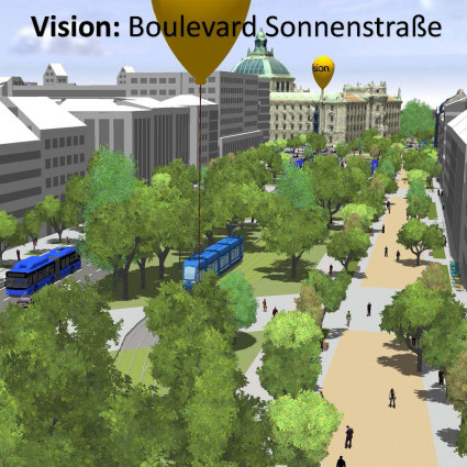
Boulevard Sonnenstraße
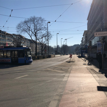
From the 19th to the 20th century, the people of Munich knew Sonnenstraße as a fashionable boulevard with parks. When in 1938 the National Socialists found the St. Matthew's Church to be disruptive to the flow of traffic on Sonnenstrasse and demolished it, the way was clear for the later Altstadtring to be extended. This busy and unattractive traffic artery separated Altstadt and Ludwigsvorstadt, and the greenery disappeared in favor of motorized traffic.
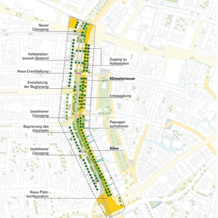
Today, the idea of the boulevard is back. Munich's inner city should adapt to climate change: More trees, more seating, fewer parking spaces and new open spaces - these are the goals of the Freiraumquartierskonzept. This conceptual framework planning examines where changes are possible.
The open space district concept for the city center initially focuses on Sonnenstrasse and Herzog-Wilhelm-Strasse. Visions of the future were developed for these areas with the help of the digital twin: For the "Boulevard Sonnenstraße" as a promenade, more planting and less traffic are planned, and in Herzog-Wilhelm-Straße, the existing green spaces are to be expanded into a park and the city stream there is to be reopened. The digital twin makes simulations of such visions possible.
- Planning: city of munich, department of urban planning
- Project management: mahl gebhard konzepte
Photo credits
LHM, mahl-gebhard-konzepte, LHM, mahl-gebhard-konzepteDie Standorterkennung ist fehlgeschlagen.
Bitte prüfen Sie die Standortfreigaben Ihres Browsers und/oder die Systemeinstellungen Ihres Gerätes.
Mehr dazu auf unserer Hilfeseite.