Back to tour Olympic Park
Olympiasee lake and Olympiaberg summit
Olympiasee lake and Olympiaberg summit
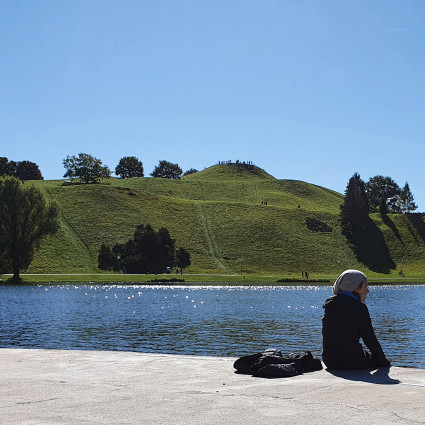
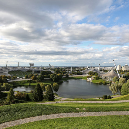
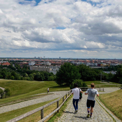
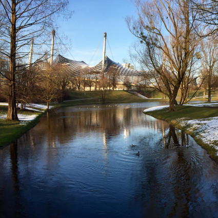
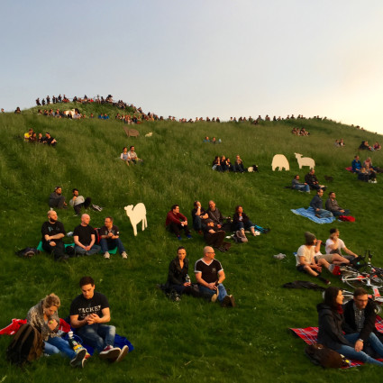
The 8.6 hectare Olympiasee was created by damming the Nymphenburg-Biederstein Canal in the 18th century. The shore of the lake runs in a variety of curved shapes forming peninsulas, bays and narrow inlets. Bridges and footbridges provide crossings and ingress. There is a bird island in the western part of the water. The lake also absorbs the excess water that runs off the hard-landscaped areas in heavy rain. The shape of the Olympiaberg, artificially created from the rubble of the Second World War, is based on the pre-Alpine landscape. Munich's highest elevation (565 metres above sea level) measures 60 metres to the summit, and is a popular vantage point. The Olympiaberg completes the classic Olympic triad consisting of a sports facility, lake and hill. The landscape architect Günther Grzimek wanted visitors to ‘own’ the park and the hill; to take possession of it as a landscape of use and to participate in the design themselves, in the form of trails.
Profile
- Builder: Organisationskomitee für die Olympischen Spiele in München, 1972
- Planning: Behnisch & Partner, Günther Grzimek
- Landscape architecture: Günther Grzimek
- Construction period: 1969-1972
Photo credits
LHM, Michael Nagy/LHM, Florian LeckertDie Standorterkennung ist fehlgeschlagen.
Bitte prüfen Sie die Standortfreigaben Ihres Browsers und/oder die Systemeinstellungen Ihres Gerätes.
Mehr dazu auf unserer Hilfeseite.